The Arabian Peninsula's Borders Based on Per Capita GDP
Nov 10, 2017

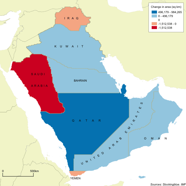
The geographically accurate cartogram above represents the borders of the nations in the region based on their per capita GDP. Qatar becomes the largest state in the region by far and is nearly double the size of the second largest state.
The Arabian Peninsula's Borders Based on Population
Nov 9, 2017

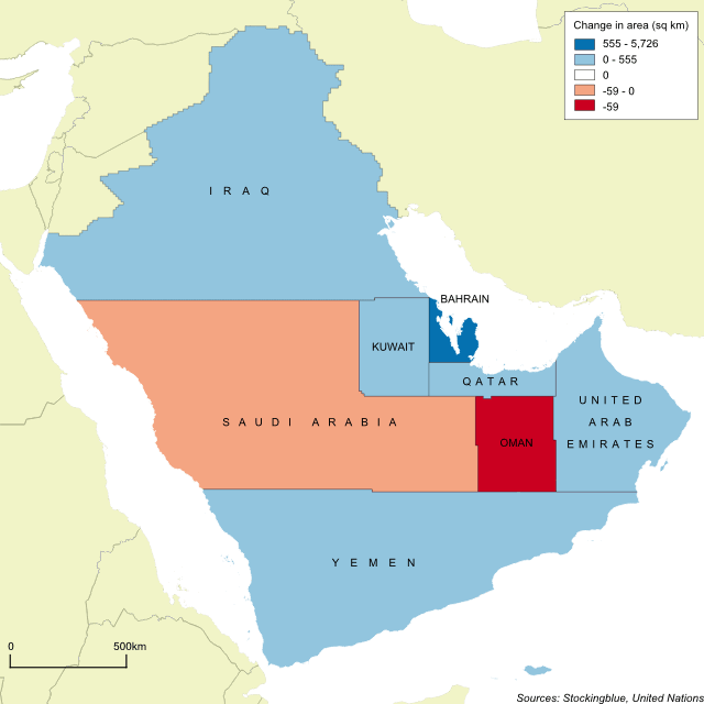
The geographically accurate cartogram above represents the borders of the nations in the region based on their population. Iraq becomes the largest country with Saudi Arabia a close second.
Newer