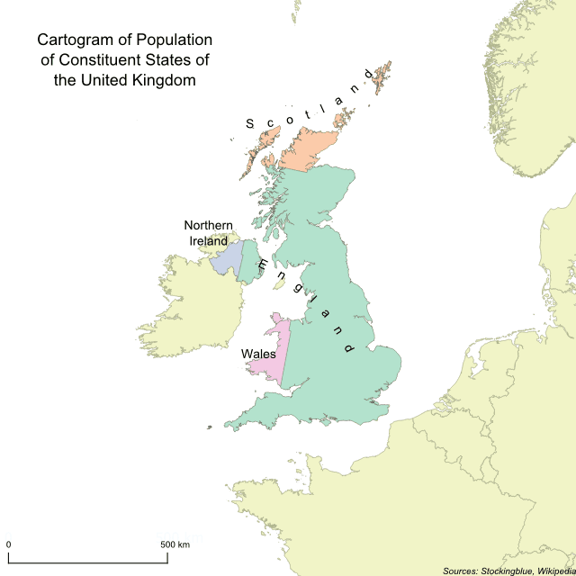
In this geographically accurate cartogram, the constituent states of the United Kingdom are redrawn according to their population. England is the only state to gain territory at the expense of the other three.
Findings
- England has the largest population, and thus claims the largest amount of territory.
- Scotland, Northern Ireland, and Wales all lose territory.
- England makes up over four-fifths of the total population of the United Kingdom.
Caveats
- Population data is from 2015.
- The map is presented in an Albers equal-area conic projection.
Details
In absolute terms, England gains the most territory while Scotland loses the most.
In relative terms, England gains the most territory gaining 58.02% more land. Scotland loses the most territory ceding 74.55% of its land.
Northern Ireland loses half of its territory while Wales loses just over two-fifths.
England is the largest state geographically as well as in population. Conversely, Northern Ireland remains the smallest state as it is both smallest geographically and in terms of population.
The total population of the United Kingdom 65,110,000.
Data
| State | Population |
|---|---|
| England | 54,786,300 |
| Northern Ireland | 1,851,600 |
| Scotland | 5,373,000 |
| Wales | 3,099,100 |
Sources
Wikipedia. 2019. "Countries of the United Kingdom." Accessed October 30, 2019. https://en.wikipedia.org/wiki/Countries_of_the_United_Kingdom